I assembled this a few years ago because even I forget some of the boats and events I sailed. Still fond memories; and still making more.
Category: hurricane
HURRICANE SEASON 2017
HURRICANE SEASON
In its 2014 Atlantic hurricane season outlook, the National Oceanic and Atmospheric Administration’s (NOAA) Climate Prediction Center is forecasting a near-normal or below-normal season.
The main driver of this year’s outlook is the anticipated development of El Niño this summer. El Niño causes stronger wind shear, which reduces the number and intensity of tropical storms and hurricanes. El Niño can also strengthen the trade winds and increase the atmospheric stability across the tropical Atlantic, making it more difficult for cloud systems coming off of Africa to intensify into tropical storms.
The outlook calls for a 50 percent chance of a below-normal season, a 40 percent chance of a near-normal season, and only a 10 percent chance of an above-normal season. For the six-month hurricane season, which begins June 1, NOAA predicts a 70 percent likelihood of 8 to 13 named storms (winds of 39 mph or higher), of which 3 to 6 could become hurricanes (winds of 74 mph or higher), including 1 to 2 major hurricanes (Category 3, 4 or 5; winds of 111 mph or higher).
These numbers are near or below the seasonal averages of 12 named storms, six hurricanes and three major hurricanes, based on the average from 1981 to 2010. The Atlantic hurricane region includes the North Atlantic Ocean, Caribbean Sea and Gulf of Mexico.
“Thanks to the environmental intelligence from NOAA’s network of earth observations, our scientists and meteorologists can provide life-saving products like our new storm surge threat map and our hurricane forecasts,” said Kathryn Sullivan, Ph.D., NOAA administrator. “And even though we expect El Niño to suppress the number of storms this season, it’s important to remember it takes only one land falling storm to cause a disaster.”
Gerry Bell, Ph.D., lead seasonal hurricane forecaster with NOAA’s Climate Prediction Center, said the Atlantic – which has seen above-normal seasons in 12 of the last 20 years – has been in an era of high activity for hurricanes since 1995. However, this high-activity pattern is expected to be offset in 2014 by the impacts of El Niño, and by cooler Atlantic Ocean temperatures than we’ve seen in recent years. – NOAA, read on
National Hurricane Preparedness Week is May 25-31. NOAA offers hurricane preparedness tips, along with video and audio public service announcements in both English and Spanish, featuring NOAA hurricane experts and the FEMA Administrator atwww.hurricanes.gov/prepare
HURRICANE “SANDY”
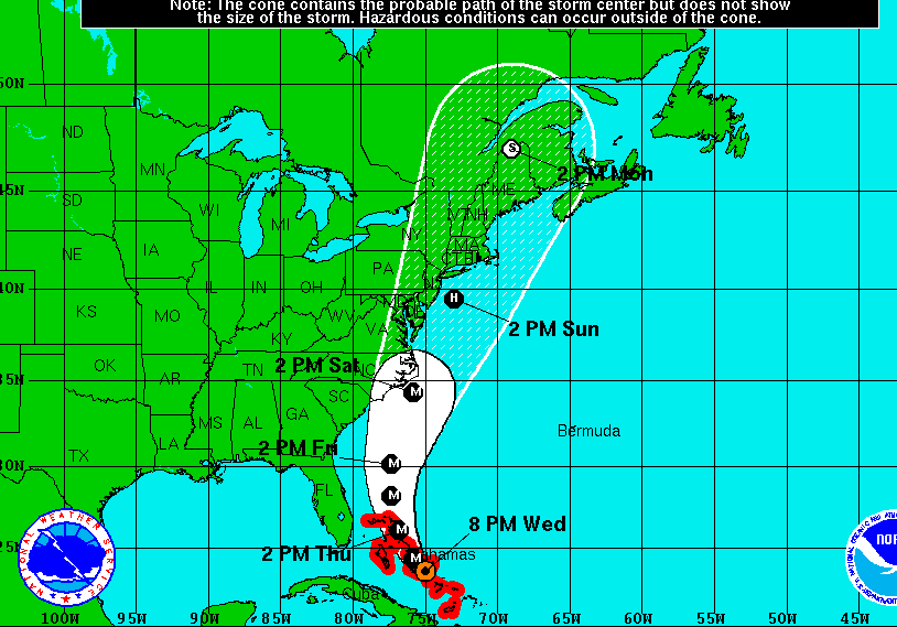
If you live on the east coast of the United States, The story of the hour is the arrival of Hurricane Sandy. I have trouble believing that the combination of the time of year and the water temperature that for us in Rhode Island this could arrive as more than a tropical storm. The weather models are still in conflict as to exactly what will happen and weather as we all know is subject to change.
THE HURRICANE FORECAST FOR 2012
Spring came early and the winter was relatively mild.The ocean had had plenty of time to start warming.Tropical storm Alberto is moving up the East Coast. We expect to have a drought here in the Northeast. My conclusion would be that this would be an active Hurricane season. It seems I am wrong.
GREAT STORM FOOTAGE
the joachim storm on the French coast december 16, 2011
IDEC AND IRENE
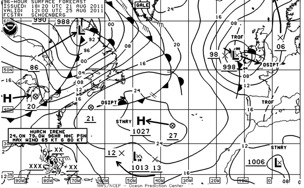
Hurricane’s are my one true worry. They are destructive, therefore I always worry about them. As a true New Englander I am always waiting for the other shoe to drop. I would never want to wish harm to someone else, but neither do I wish to have an encounter with Irene.
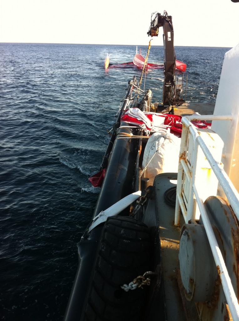
Now an update on IDEC and Francis Joyon. The capsized trimaran is under tow, now that the mast has been removed from the boat, to a safe harbor where righting the boat will be attempted.
FIRST HURRICANE OF THE SEASON
For those of us who live on the east coast, it is the time of year where we are looking over our shoulders. The season officially starts in June, but for the east coast the water temperature and weather systems are not established to guide the storms to us until near now. Really September and October are our danger zone. Hurricanes are apart of life for us, unfortunately. They seems to arrive just when the trees are most vulnerable; the foliage is full and heavy adding considerable surface area. The Midwest has tornado season, which is far more destructive. The power of the tornadoes dwarfs that of most hurricanes.
HURRICANE SEASON 2011
The devastation in the south and mid-west this spring from rain and tornadoes was unprecedented. It makes me wonder what might be in store for us in the northeast with hurricane season about to start. The La Nina effect is diminishing. It might seem that is good news; but I am not so sure that is true.
2011 Hurricane Season Will Be Above Average, Top Meteorologists Say
Published May 19, 2011 | FoxNews.com
The nation’s top meteorologists issued their 2011 hurricane-season forecast Thursday, predicting a serious and above-average season — though not one as tumultuous as the violent 2010 season.
Hurricane season for the western Atlantic and the Gulf of Mexico begins June 1 and lasts through Nov. 30. That’s when about 90 percent of the storms make themselves present. The National Oceanic and Atmospheric Administration (NOAA) warned that this year’s season will be above average, with as many as 10 hurricanes blasting their 110 mile per hour winds across the area.
“We could see activity comparable to some of the active seasons since 1995,” said Gerry Bell, Ph.D., lead seasonal hurricane forecaster at NOAA’s Climate Prediction Center.
2011 will be above average — even severe, the agency said — but probably not as dramatic as last year.
“This year, we are unlikely to see a repeat of last year,” said Jane Lubchenco, Ph.D., under secretary of commerce for oceans & atmosphere and NOAA administrator. The 2010 hurricane season was predicted to be devastating, with as many as 14 hurricanes; it ended up as the third most active on record.
Despite the above average 2010 hurricane season, the country did not have significant damage last year, Lubchenko said. But she urged caution nonetheless. “We cannot count on having the same luck this year,” she said.
NOAA’s forecast for 2011 predicts 12 to 18 named storms with winds 39 mph or greater. Of those, NOAA expects 6 to 10 hurricanes with winds of at least 75 miles per hour. And of those, the meteorologists expect 3 to 6 could be major storms, with winds of 110 mph or greater.
The outlook does not forecast when or where these storms will hit, Lubchenco cautioned.
The waters in the Atlantic ocean are not as warm as they were last year, NOAA said, though they are still warm enough to support an above average season. La Nina, which continues to weaken in the equatorial Pacific Ocean, is expected to dissipate later this month or in June. But its impacts — such as reduced wind shear — are expected to continue into the hurricane season and will help boost hurricane formatoin.
This prediction aligns with the forecast issued in early April by Colorado State University meteorologists Philip Klotzbach and William Gray, who predicted a strong forecast for 2011 as well.
“Overall, conditions remain conducive for a very active hurricane season,” their forecast reads.
The national weather agency urged caution and preparedness for anyone who lives within the hurricane evacuation zone.
“The tornadoes that devastated the South and the large amount of flooding we’ve seen this spring should serve as a reminder that disasters can happen anytime and anywhere,” said FEMA Administrator Craig Fugate.
“As we move into this hurricane season it’s important to remember that FEMA is just part of an emergency management team that includes the entire federal family, state, local and tribal governments, the private sector and most importantly the public,” he said.
May 22-28 is national Hurricane Preparedness Week, the agency noted, and urged residents of hurricane-prone areas to prepare by watching a set of new video and audio announcements featuring NOAA hurricane experts.
NOAA had predicted the 2010 season would be one of the strongest seasons on record — a forecast that stirred fears that the Gulf oil spill would be impacted by the severe weather.
Read more: http://www.foxnews.com/scitech/2011/05/19/2011-hurricane-season-noaa-forecast/#ixzz1MtWl38iE
Weather in the Northeast
Emerging from a winter that I personally found hard, despite the fact I have lived through worse. Winter ended with what seemed to be endless rain, here in the northeast. Anyone who has followed the news has seen the damage too much rain can reek. Like the flowers, we turn our faces to the sun anxious to absorb her glorious rays.
The rivers in Rhode Island, attracted early industry as they provided power and transportation proved to be the undoing of so many people living near them.
Spring seems to be about three weeks “early”in stark contrast to last year when we seemed to abruptly have gone from winter the summer, leaving spring out of the equation. I am already wondering if this mild spring will lead to warmer water leading into the fall and therefore the possibility of a hurricane. We have dodged this manifestation of nature in recent history, only adding to the potential probability.


